
The plot looks perfect in person. It is level, it sits on a good road, and the seller walks you across it with easy confidence. Then you lay the paperwork next to the land and the shapes do not match. The napi naksa, the official survey map tied to the ownership certificate, describes a narrower parcel set back from the road. This is one of the most common and expensive traps in Nepal’s land market, and it is also one of the easiest to avoid. The survey map is the single document that proves where your boundaries actually run, yet most buyers never learn to read it.
A lalpurja tells you who owns the land and how much of it there is. The napi naksa tells you its exact shape, its orientation, and where its lines fall relative to the plots around it. Read together, they let you confirm that the land on paper and the land under your feet are the same thing. Here is how to read the map, where to get an authentic copy, and how to check its lines against the ground before any money changes hands.
Key Takeaways
- A napi naksa (cadastral survey map) shows your plot’s kitta number, its scale, a north arrow, and its boundary lines with dimensions. These four elements let you confirm shape and orientation against the real plot.
- Nepal has roughly 24 million land parcels on record. The national cadastral survey ran from 1965 to 1997, and most maps still exist as paper sheets at scales of 1:500, 1:1250, and 1:2500.
- You can request an official map print, plot register, and field book online through Mero Kitta (merokitta.dos.gov.np), the Department of Survey portal launched on 15 April 2021 and backed by the NeLIS database.
- Every plot now carries a Parcel Identification Number (PIN) and every owner a Landowner Identification Number (LIN), which link the map, the register, and the certificate.
- When the map and the ground disagree, the fix is a fresh field survey by a licensed amin. A standard boundary survey runs about NPR 15,000 to NPR 50,000.
- Hill plots are measured in ropani-aana-paisa-daam; Terai plots in bigha-kattha-dhur. One bigha equals 13.31 ropani, so a unit mix-up can distort price and area badly.
What a napi naksa actually is
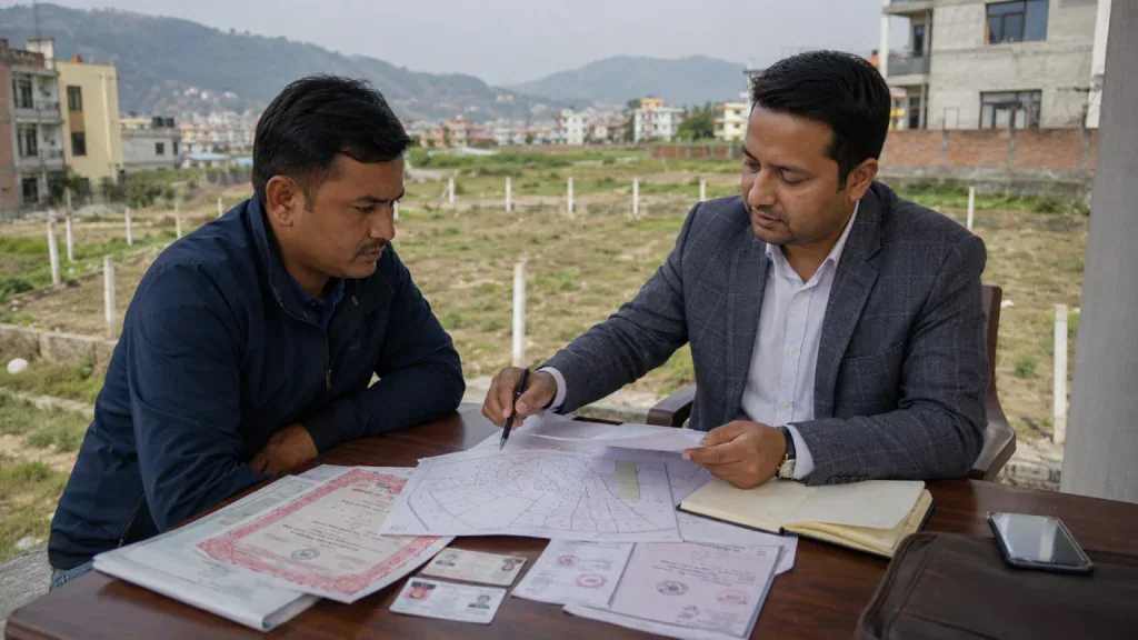
A napi naksa is the cadastral map of a land parcel: a scaled drawing that records the plot’s shape, boundaries, and position relative to its neighbors. It is produced and held by the Department of Survey, which works under the Ministry of Land Management and operates more than 120 survey offices across the country. The map is the geometric half of your ownership record. The lalpurja is the textual half. They are meant to describe the same piece of ground, and the point of reading the map is to make sure they still do.
Since 2021, that record has a digital spine. The Nepal Land Information System (NeLIS) is the central database that stores survey and parcel data from offices nationwide, and Mero Kitta is the public-facing portal that lets citizens apply for and download their records. At launch, 18 of 126 survey offices had not yet been integrated, so coverage is strong but not yet universal. The modern system also assigns a Parcel Identification Number (PIN) to each plot and a Landowner Identification Number (LIN) to each owner, which is how the map, the plot register, and the certificate are tied together under one reference.
For deeper context on the ownership certificate that sits beside the map, see our guide on what a lalpurja is and how to read it.
The four things to read on the map first
Every cadastral map carries the same core elements. Learn these four and you can check most of what matters without a surveyor standing next to you.
- Kitta number. This is the unique identification number for your specific parcel. It must match the kitta number on the lalpurja exactly. A plot with no matching kitta number on the map is a plot you cannot verify.
- Scale. Nepali cadastral maps are drawn at fixed scales, usually 1:500 in dense urban areas and 1:1250 or 1:2500 elsewhere. A scale of 1:500 means one centimeter on the map equals five meters on the ground. The scale is what lets you translate the drawing into real distances.
- North arrow. This fixes the orientation of the plot. Without it, a square drawing tells you nothing about which edge faces the road or the neighbor. Use it to line the map up with the actual compass direction when you stand on the land.
- Boundary lines and dimensions. The outline shows the plot’s exact shape, and the measurements along each edge give its lengths. Compare the shape on paper with the shape of the plot in front of you. A rectangle on the map and an L-shaped plot on the ground is an immediate red flag.
Reading the area: ropani versus bigha
Area is where buyers lose the most money through simple confusion. Nepal runs two measurement systems. The hills and the Kathmandu Valley use the ropani system; the Terai uses the bigha system. The two are not interchangeable, and a figure quoted in the wrong unit can overstate or understate a plot by an order of magnitude. The exact conversions are below.
| Unit | System | Square meters | Square feet |
|---|---|---|---|
| 1 Ropani (= 16 Aana) | Hill / Valley | 508.74 | 5,476 |
| 1 Aana (= 4 Paisa) | Hill / Valley | 31.80 | 342.25 |
| 1 Paisa (= 4 Daam) | Hill / Valley | 7.95 | 85.56 |
| 1 Bigha (= 20 Kattha) | Terai | 6,772.63 | 72,900 |
| 1 Kattha (= 20 Dhur) | Terai | 338.63 | 3,645 |
| 1 Dhur | Terai | 16.93 | 182.25 |
When you read area from the map, confirm it is stated in the system that matches the plot’s location, then check that figure against the area written on the lalpurja. The two should agree. A mismatch between the map area and the certificate area is a problem to resolve before you buy, not after.
How to get an authentic copy
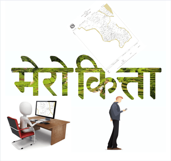
Do not rely on a photocopy handed over by the seller. Get the map from the source. There are two routes.
Online, through Mero Kitta. You upload clear scanned copies of the lalpurja and a citizenship certificate, each kept under the portal’s small file-size limit, then apply for the document you need: a map (naksa) print, a plot register print, or a field book (srestha) print. After verification you are told the fee, pay through Connect IPS or a bank voucher, and download the finished PDF, which stays available for about seven days. The portal also supports online land-tax payment.
In person, at the survey office. The local Survey Office (Napi Karyalaya) still issues printed copies, and for plots in the 18 or so offices not yet digitized this remains the only route. Be aware of one quirk worth planning around: many offices still reproduce blueprints with an ammonia printing method in use since the 1960s, which, as The Himalayan Times has reported, can fail on dull, overcast days. On a cloudy afternoon you may simply be told to return tomorrow.
Confirm the boundaries on the ground

A clean map is necessary but not sufficient. The map describes the land as it was last surveyed, which may have been decades ago. The ground is where disputes actually live. Three checks close the gap.
Walk the four boundaries (char killa). Stand on the plot with the map oriented to the north arrow and trace each edge. Confirm that the kitta number, the plot shape, the stated area, and the four boundaries on the survey map match the plot you are actually standing on. As the property guide from Basobaas notes, a frequent scam is to show a buyer one attractive plot while the paperwork quietly points to a different, inferior parcel nearby.
Check for encroachment and overlap. Look for boundary markers, signs that a neighbor is using part of the land, drainage or slope issues, and real road access. Boundary mismatches and overlaps with an adjoining plot are common in Nepal, often because adjacent maps were drawn or updated at different times. A fence that sits a meter inside the mapped line is a dispute waiting to surface.
Bring a licensed surveyor for anything uncertain. An amin (licensed surveyor) can run a formal boundary survey with GNSS receivers and a total station, then produce a scaled drawing you can submit to the Land Revenue Office (Malpot). Expect roughly NPR 15,000 to NPR 50,000 for a standard boundary survey. Against a purchase worth lakhs or crores, that is cheap insurance. Our property safety assessment guide covers the structural and geological checks that pair with this boundary work.
When the map and the ground do not agree
Discrepancies are not rare, and they are not always fraud. Plots get subdivided through kitta kat, old maps drift out of date, and manual surveys carry error. If the shape, area, or boundaries on the map do not match the field, do not proceed on the seller’s assurance. The remedy is a fresh survey by the Survey Office or a licensed amin, followed by correction of the record so the map, the register, and the certificate agree. Buying into a known mismatch means inheriting the dispute, and in Nepal boundary disputes can take years to resolve. For how subdivision reshapes parcels and multiplies these mismatches, see our analysis of land fragmentation and kitta kat, and browse more guides in our Real Estate section.
The discipline is simple to state and worth repeating: get the authentic map, read its four core elements, confirm the area in the correct unit system, and walk the boundaries with the map in hand before you pay. The survey map is the one document that cannot be talked around. Let it do its job.
Frequently Asked Questions
1. What is a napi naksa?
A napi naksa is the official cadastral survey map of a land parcel in Nepal. It is a scaled drawing, held by the Department of Survey, that records the plot’s kitta number, shape, boundary lines and dimensions, scale, and orientation. It is the geometric counterpart to the lalpurja, which records ownership and area in text.
2. How do I get an official copy of my land’s survey map?
Apply online through Mero Kitta (merokitta.dos.gov.np) by uploading scanned copies of your lalpurja and citizenship certificate, paying the stated fee via Connect IPS or a bank voucher, and downloading the PDF, which remains available for about a week. Alternatively, request a printed copy in person at your local Survey Office (Napi Karyalaya).
3. What should I check on a survey map before buying land?
Check four elements: the kitta number (it must match the lalpurja), the scale (commonly 1:500 in cities), the north arrow (for orientation), and the boundary lines and dimensions (to confirm shape). Then confirm the area is stated in the correct system, ropani for hills, bigha for the Terai, and that it matches the certificate.
4. What is a kitta number?
A kitta number is the unique identifier for a single land parcel in Nepal’s cadastral records. It appears on both the survey map and the lalpurja, and the two must match. The modern system also assigns each parcel a Parcel Identification Number (PIN) that links the map, plot register, and certificate.
5. What do I do if the map and the ground do not match?
Do not buy on the seller’s assurance. Commission a fresh boundary survey from the Survey Office or a licensed amin, then have the record corrected so the map, register, and certificate agree. Buying into a known mismatch means taking on the dispute, which can take years to resolve in Nepal.
6. How much does a boundary survey cost in Nepal?
A standard boundary survey by a licensed surveyor typically costs about NPR 15,000 to NPR 50,000, depending on the plot and location. More detailed topographic surveys cost more. Against a land purchase worth lakhs or crores, a boundary survey is inexpensive protection.