Nearly half of Kathmandu Valley sits on soil that could turn to liquid during a major earthquake. Meanwhile, families on the surrounding hillsides build homes on slopes that could give way in a heavy monsoon. Both risks are well documented. Both keep getting built on anyway.
Landslide and liquefaction risk in Nepal isn’t a fringe engineering concern. It’s a defining feature of the country’s entire real estate landscape, shaping where people can afford to live, what land actually costs, and how much genuine safety that cost buys.
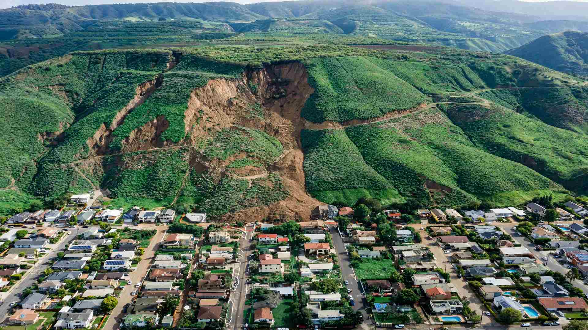
Nepal’s geography offers two distinct danger zones: steep, deforested hillsides prone to landslides, and valley floors built on ancient lake sediment prone to liquefaction. Both continue attracting construction, often driven less by ignorance than by simple land scarcity.
Understanding exactly how much of Nepal’s most populated areas fall into these high-risk categories, and what that means economically, reveals a genuinely urgent tension between housing demand and geological reality.
In this article, we’ll examine the scientific data behind Nepal’s landslide and liquefaction risk, how it intersects with real estate economics, and what’s being done, and left undone, to address it.
Kathmandu Valley’s Hidden Liquefaction Problem
Beneath much of Kathmandu Valley’s dense urban development lies a geological history that makes the ground itself a genuine hazard during earthquakes.
According to a 2023 study published in Geotechnical and Geological Engineering, Kathmandu Valley sits atop fluvio-lacustrine deposits, sediment from an ancient lake, with shallow groundwater throughout much of the basin, conditions that make the soil genuinely susceptible to seismic liquefaction. Using 143 standard penetration test profiles across the valley, researchers found that 44.4% of the valley’s area falls into the very high liquefaction risk category, with a further 28.36% classified as high risk. Only 21.53% qualified as low risk, and just 5.71% as very low risk.
This isn’t a theoretical concern. According to the same research, extensive liquefaction was observed in Kathmandu Valley during the devastating 2015 Gorkha earthquake, confirming that the risk these calculations describe has already materialized once, with real, documented consequences.
Where the Risk Actually Concentrates
Liquefaction risk isn’t evenly distributed across the valley. A separate study, published in Geoenvironmental Disasters and based on 410 borehole locations across three likely earthquake scenarios, found that the central and southern parts of Kathmandu Valley are more susceptible to liquefaction, precisely the areas that also happen to be among the most densely developed and populated.
The implications for critical infrastructure specifically are striking. According to research published in the journal examining seismic liquefaction risk to critical facilities, 42% of Kathmandu Valley’s road network and 16% of its airport area sit within very high liquefaction susceptibility zones. Even more concerning, 60% of health facilities, 54% of schools, and 64% of colleges in the valley fall within these very high-risk zones.
This means the infrastructure Nepal depends on most during an actual emergency, hospitals and schools serving as shelters, roads needed for evacuation and rescue, sits disproportionately on ground most likely to fail when an earthquake strikes.
The Hillside Side of the Equation
While the valley floor faces liquefaction risk, Nepal’s surrounding hills face an entirely different, but equally serious, geotechnical hazard.
According to SKR Groups’ 2026 construction guide, landslide risk in Nepali house construction stems from overlapping factors: steep terrain, intense seasonal monsoon rainfall, widespread deforestation on hillsides, and rivers that continuously undercut their banks. The guide is direct about the economic driver behind risky construction choices: building too close to a slope edge or riverbank is dangerous, but land scarcity sometimes leaves families with few other options.
This tension, between geological safety and the simple economics of available, affordable land, sits at the heart of Nepal’s slope stability problem. The same guide notes that a proper geological assessment before purchasing land or starting construction can reveal whether a site sits on an old landslide deposit or near an unstable zone. Yet, this kind of professional assessment represents an additional cost many households, already stretching to afford land at all, may struggle to justify or access.
What Disaster Data Reveals About the Real Cost
Nepal’s history with these hazards offers concrete, quantified evidence of what happens when this risk goes unmanaged.
According to research published on Kathmandu Valley’s urban growth and vulnerability, the 2015 Gorkha earthquake caused over USD 7 billion in economic losses, alongside approximately 9,000 deaths and 22,300 injuries, with the earthquake triggering several liquefaction events across the valley. Just two years later, in 2017, monsoon flooding struck 80% of the Terai region and surrounding districts, causing USD 584.7 million in damage.
More recently, according to Wikipedia’s documentation of the 2024 Nepal floods, Kathmandu Valley received between 240 and 322 millimeters of rainfall over just two days at the end of September 2024, triggering flooding that killed at least 224 people, injured 158, and left 28 missing. The disaster required rescuing around 13,300 people and destroyed or damaged at least 1,200 houses, alongside 25 bridges, 37 highways, 11 hydropower stations, and numerous telecommunication facilities.
This risk trajectory isn’t stable either. According to the same urban vulnerability research, monsoon precipitation across Nepal is projected to rise 3% to 8% in the medium term through 2045, and 9% to 14% in the long term through 2065, meaning the rainfall-driven landslide and flooding risk compounding Nepal’s real estate landscape is expected to intensify, not ease, in the coming decades.
Building Codes Exist, But Compliance Remains Inconsistent
Nepal isn’t without regulatory tools meant to address this risk directly. The gap lies mainly in how consistently those tools actually get applied.
According to Nepal’s construction laws, the National Building Code, introduced in 1994, explicitly requires site selection that avoids fault lines, landslide zones, and liquefaction-prone areas, alongside requirements for proper foundation design, material quality, and structural symmetry specifically to improve earthquake resilience. This represents a legally established, decades-old recognition that hazard-aware site selection should be central to Nepal’s construction process.
Nepal significantly updated this framework recently too. According to Nepal Energy Forum’s November 2025 reporting, the government revised and enforced a new National Building Code specifically to ensure earthquake-resistant construction, published in the Nepal Gazette and developed with input from the Society of Structural Engineers Nepal and international experts. Former Urban Development Minister Kulman Ghising described the revision as “a milestone in building a safer future for the country,” with the updated code also extending guidance to dams, powerhouses, and other hydropower-related structures.
However, actual compliance with these standards remains genuinely inconsistent. According to academic research examining building bylaw compliance in Kathmandu Valley apartments, the implementation and compliance of building bylaws and codes in Nepal are, in the study’s own words, “always questionable.” While the specific 13 apartment buildings studied showed largely satisfactory code compliance, the broader informal housing sector, where most individual homes get built, likely faces considerably less consistent enforcement, particularly regarding the kind of site-selection provisions meant to steer construction away from landslide and liquefaction zones in the first place.
The Reconstruction Gap That Followed the 2015 Earthquake
Perhaps the clearest evidence of how deeply geotechnical risk intersects with real estate economics comes from Nepal’s own post-earthquake reconstruction experience, a full decade later.
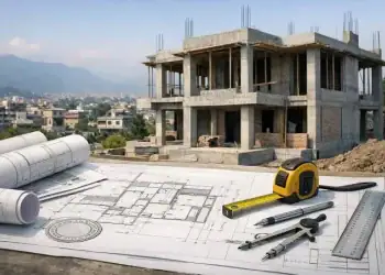
According to research published in Buildings & Cities in March 2026, examining reconstruction in Kathmandu and neighboring Lalitpur, a decade after the 2015 Gorkha earthquake, reconstruction efforts remain incomplete, with sites still vacant despite genuinely increasing housing demand. The research specifically investigated why concrete-frame construction has become the dominant rebuilding choice, even in historically significant areas where heritage preservation goals would favor different building approaches.
This reconstruction delay connects directly to financing constraints that shape who can actually afford to rebuild safely. According to the same research, commercial banks currently offer mortgage products at around 8% interest, with a maximum 80% loan-to-value ratio for a first home, alongside strict eligibility criteria and collateral requirements. Alternative financing through member funds like the Employees Provident Fund offers somewhat better rates, around 7.25%, but only for contributing members employed in the formal sector workforce, excluding much of Nepal’s informal economy. Smaller cooperative options exist too; the research cites Nava Astha Women Cooperative in Chyasal offering NPR 500,000 at 10% interest with no collateral required, though this figure falls well short of average Kathmandu Valley housing construction costs.
A Genuine Pilot Attempting to Bridge This Gap
Amid these financing and reconstruction challenges, at least one concrete pilot project is attempting to demonstrate a genuinely different, more accessible rebuilding model.
According to the Buildings & Cities research, an infill housing prototype project in Lalitpur aims to complete construction by September 2026, functioning as a demonstration pilot specifically intended to provide proof of performance and shift policy toward recognizing and subsidizing this housing model more broadly. This approach targets exactly the kind of small, vacant urban plots that have remained undeveloped since 2015, offering a potential template for denser, more affordable, and hopefully more hazard-conscious infill development within Kathmandu Valley’s existing footprint, rather than continued expansion into unstable hillside or high-liquefaction-risk peripheral areas.
Why Cheap Land Often Means Risky Land
Bringing these threads together reveals the core economic logic driving Nepal’s geotechnical risk exposure. Land in genuinely stable, low-risk locations tends to command a premium, precisely because that stability itself is valuable. Land on steep hillsides, near unstable riverbanks, or on unverified fill in flood-prone valley margins tends to be cheaper, precisely because of the risk it carries.
For households facing Nepal’s broader affordability constraints, discussed extensively in the context of the country’s land valuation gap and financing limitations, this creates a genuinely difficult trade-off. Safer land costs more. Riskier land is what many families can actually afford. Without stronger enforcement of hazard-aware site selection requirements already written into the National Building Code, or genuinely accessible financing options that make safer sites competitive with cheaper, riskier alternatives, this economic logic will likely keep pushing development toward exactly the zones geological research has identified as most dangerous.
What Would Genuinely Reduce This Risk
Given how deeply this problem runs, several concrete steps could help Nepal meaningfully reduce its landslide and liquefaction exposure over time.
First, strengthening enforcement of the National Building Code’s existing site-selection provisions, particularly for informal, individually built housing rather than just regulated apartment developments, would help ensure hazard-zone avoidance requirements translate into genuine practice, not just documented policy.
Second, expanding accessible geological assessment services, potentially subsidized for lower-income households, would help address the gap SKR Groups identified, where proper site evaluation remains an added cost many families can’t easily absorb before purchasing land.
Third, scaling successful models like the Lalitpur infill housing pilot, if it demonstrates genuine viability by its September 2026 target, could offer a policy-supported pathway toward denser, safer development within Kathmandu Valley’s existing urban footprint, reducing pressure to expand into higher-risk peripheral and hillside zones.
Finally, continuing to update and enforce the revised 2025 National Building Code specifically for critical infrastructure, given how disproportionately schools, health facilities, and roads currently sit within Kathmandu Valley’s highest liquefaction-risk zones, deserves particular priority given these facilities’ essential role during any future disaster response.
Why This Trend Deserves Long-Term Tracking
Landslide and liquefaction risk in Nepal deserves sustained attention as a structural indicator connecting geological science directly to housing affordability and disaster preparedness.
First, tracking building code compliance rates specifically for informal, individually constructed housing, not just regulated apartment developments, would reveal whether Nepal’s hazard-aware site-selection requirements are genuinely reducing risky construction, or remaining largely aspirational outside formally monitored projects.
Second, monitoring reconstruction progress and infill housing adoption in Kathmandu Valley would show whether Nepal is successfully redirecting development toward safer, denser urban infill, or continuing to push new construction into higher-risk peripheral and hillside areas.
Third, tracking the relationship between land price and documented hazard zones would help quantify exactly how much of Nepal’s affordable housing stock sits within high-risk areas, providing a clearer picture of how many households currently face this trade-off.
Conclusion
Landslide and liquefaction risk in Nepal represents a genuine, scientifically documented threat that intersects directly with the country’s real estate economics. With 44.4% of Kathmandu Valley classified as very high liquefaction risk, and more than half of the valley’s schools and health facilities sitting in these highest-risk zones, the stakes extend well beyond individual homeowners to the infrastructure an entire disaster response would depend on.
Nepal has real regulatory tools in place, a National Building Code recently strengthened in November 2025, explicit site-selection requirements dating back to 1994, and emerging pilot projects like Lalitpur’s infill housing model working to demonstrate safer, more affordable alternatives. Yet, compliance gaps, financing constraints, and the simple economics of cheap land continue pushing construction toward exactly the zones geological research warns against.
As climate projections point toward intensifying monsoon rainfall in the decades ahead, closing the gap between what Nepal’s building codes require and what actually gets built will matter more, not less, for the country’s growing, and increasingly exposed, urban population.
FAQ: Landslide and Liquefaction Risk in Nepal
How much of Kathmandu Valley is at risk of liquefaction?
Research shows 44.4% of Kathmandu Valley falls into the very high liquefaction risk category, with a further 28.36% classified as high risk.
Why is Kathmandu Valley so vulnerable to liquefaction specifically?
The valley sits on fluvio-lacustrine deposits, sediment from an ancient lake, with shallow groundwater, conditions that make the soil highly susceptible to liquefying during earthquakes.
What causes landslide risk in Nepal’s hillside areas?
Steep terrain, intense monsoon rainfall, widespread deforestation, and riverbank erosion all combine to create significant landslide risk across Nepal’s hill regions.
Does Nepal have building codes addressing these risks?
Yes. The National Building Code, first introduced in 1994 and significantly revised in November 2025, explicitly requires avoiding fault lines, landslide zones, and liquefaction-prone areas during site selection.
Why do people still build in high-risk areas despite known dangers?
Land scarcity and affordability often leave families with few alternatives, since safer land tends to cost significantly more than land in landslide or liquefaction-prone zones.
How much damage did past disasters cause in these risk zones?
The 2015 Gorkha earthquake caused over USD 7 billion in losses and triggered valley-wide liquefaction, while 2024 flooding alone destroyed or damaged more than 1,200 houses.